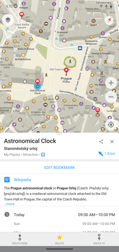
Sadly there is no browser view, but they have selection of app stores on their page for the app (and IIRC they are working on a desktop version).
It has routing, searching, more map details (e.g. park benches, trash bins on the map), OSM editing, and pretty slick look in my opinion.
I recently switched to Organic Maps after learning about it here on Lemmy and haven’t touched Google Maps as much. I know it is not a perfect 100% replacement, but while it lacks certain things (e.g. public transport, but I use local public transport app anyway for better accuracy), it has so many features google lacks:
- hiking trail overlay that is more up-to-date
- stores maps on your phone in vector format (offline use is so much nicer)
- privacy focused
There is more to this than I know and write here, and probably many here already know about Organic Maps since there was the whole fiasco of google removing this app from play store awhile back, but thought it’s cool that the company behind it is in Estonia (man I still remember Skype, thanks Estonia ❤️ I’ve spent so much time on skype before it was aquired by Microsoft).
Edit to add extra info from website: Company is based in Tallinn, Estonia - Organic Maps OÜ
Not feature-complete enough to replace OsmAnd for me yet (and maybe it never will be). OsmAnd is a nested menu nightmare of bloat and maybe Organic Maps isn’t aiming for that.
OsmAnd is also cool, but yeah I prefer the simplicity of Organic maps myself and haven’t needed much more in my day-to-day life.
Best part is: both are good replacements for google/apple (in the context of getting rid of big tech) and thankfully we can choose!
Also recommend StreetComplete to help fill in OSM data. It’s fun too :)
This seems really cool! Also on fdroid.
I’m sometimes using it and like how clean it is.
I just wish they had some way to host photos as well. My main use of maps app has been to understand what a place looks like/whether I wanna go there, or myself add some photos so others can. However, I do fear this would require strong moderation and a lot of overhead on platform like Organic Maps, unless they utilized a rather small select community for contributions.
I have hopes that in the future they will add such a service but not directly, but rather integrate another FOSS service for this (like their map information pane is often wiki text + link to the full wiki article).
I’ve found some I’ve been meaning to look at whether they are truly FOSS but I’ve been too lazy. My latest bookmark from these kind of services is kartaview: https://github.com/kartaview
Til: I just learned the project is working on a desktop version.
Also join [email protected] to discuss the app!
We need 253 more subs to beat r/organicmaps counterpart!
Yay! we’ll get there, lemmy is growing, I’ve noticed that my procrastination moments with lemmy are no longer “scroll for 2 minutes and I’ve seen the whole of lemmyverse”. I’m actually procrastinating now.
I briefly tried the development version of their desktop version on Windows 11 using WSL and would not recommend it yet, but I can imagine it works better on Linux since it is a flatpak!
(before I get butchered on lemmy: I daily drive linux at home, windows 11 is for work).
Just in case there are map nerds looking at this thread who might not know about a related app to fill OpenStreetMap attributes while having fun doing it: check out StreetComplete; PokemonGo but instead catch wrong / outdated / unmarked map information and get credited for it!
Unfortunately, no iOS app… looks cool though
Yeah sadlt :( they have started working on an iOS app but it desperately needs more contributors.
Let’s hope they manage to find help.
StreetComplete is awesome. I’ve been using it for well over a year now and it’s my go-to app for “playing outside”. To do some of the tasks you probably need the “Street measure” app as well.
Ah dammit forgot to link it, thanks for the link! Also great recommendation with the Street measure; I was ignoring measurement update “quests” because I didn’t have the means of checking them.
Worth posting to [email protected]
Just crossposted a really good thread from 3 months ago to [email protected]!
Cheers.
My main issue with Organic Maps is how bad the night mode map view is. They’ve effectively just turned the background black without adjusting street colors; so all the main orange/gold main roads have no contrast and disappear into the blackness. I’m sadly forced to keep it in Day mode just so it can be read and used, regardless of time of day. :-/
Thanks for the link to F-droid! Appreciate it!
And now: I have to admit I have the same problem. I love OM but I keep it in day mode for the same reason. Wish there was a way to turn the menus dark mode and keep the map colors…
To be fair I don’t like Google Maps’ dark mode either. Otherwise it is dark mode for every piece of software I use.
How does it compare to the fairly established Dutch HERE WeGo?
In giving this a checkout on my phone from Canada! Cheers and thanks for this.
Hey no problem! Hope it fills your needs - it doesn’t fully replace all map applications but I’ve been loving it and sticked to it in my last two trips abroad and it was enough (apart from local public transport app, which I always get on my trips because it’s essential to me).


